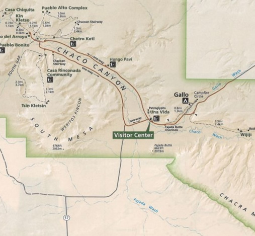
This easy loop hike is about four miles. It offers some great views of Chaco Canyon, Casa Rinconada Kiva, Pueblo Bonito, a visit to the partially restored Tsin Kletzin Pueblo ruin which sits at the very top of the south mesa. There is some nice slickrock walking, and a descent through some of Chaco Canyon's more interesting geology. The route is well marked, and there are plenty of cairns on the short slickrock sections. Photo opportunities abound. You can imagine ancient Chacoans climbing up and down from their high desert pueblo at Tsin Kletzin to visit the Grand Kiva at Rinconada, and Pueblo Bonito.
Hiking Description
Best time to hike is spring, fall, or winters. Summers are intestly hot and this exposed hike would not be pleasant. Bring a broad brim sun-hat, sunscreen, good shoes, two liters of water in spring and fall, a rain / wind jacket if weather threatens, and perhaps a sweater or pullover. Don't underestimate how much water you will need even on a modestly warm day. This is the desert southwest...
Park at the Casa Rinconada Parking lot, which is on the one way loop road and directly across from Pueblo Bonito.
Start and the trailhead sign marked "South Mesa Trail Loop". Pass through a number of smaller ruins, with the massive restored Casa Rinconada Kiva on your right. Skip visiting this Grand Kiva for now, you will visit on your return and it is a great way to end the hike. Continue to the foot of the canyon, switchback up its wall on a good dirt and rock path, and wiggle through a tiny crack, eventually reaching the slickrock rim. There are some great photo opportunities on the way. Look to the south, behind you, and you will just see Pueblo Alto on the opposite canyon-wall rim.
Once on top of the south mesa, continue south along the flattish sagebrush plain towards the obvious Tsin Kletzin ruin, passing a junction, with a trail heading west, that you will return to.
Spend some time at the Pueblo ruin. It is the highest point on this part of the rim and you can easily see across, south, to its twin, Pueblo Alto, which sits high across the canyon on the south rim and is a good spot for lunch.
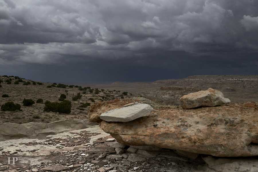
To continue the loop, return 1/8th mile south to the trail junction you passed before, turn left and head west out across the plain, past some singular junipers to the canyon rim. The view here is stunning as shown in the leading photo. You are looking northwest into another canyon that abuts Chaco. Wind down the rim, past a natural rock shelter, through some interesting sandstone bluffs to a drainage divide, South Gap, that separates two canyons on your left and right. Continue along the divide and note cairns that indicate the trail that dips down into the canyon on your right, a minor tributary to Chaco Wash.
As you slab down the canyon wall on good trail, notice the coal seams opposite you, indicating this is coal, oil and gas country. You will see these coal seams throughout the rest of your hike and you might wonder if the Anasazi used the coal to heat the vast Pueblo Bonito. Currently there is a great deal of oil and gas development in the area, though the immediate coal resource has yet to be tapped.
The trail reaches the bottom of the north trending canyon and follows it until exiting to a larger feeder canyon that trends southwest to northeast. The trail, still well defined, turns south or right, and eventually intersects and old wagon track. Turn right on the dirt track and follow it for about three quarters of a mile, up and over a little rise and to Casa Rinconada, and now is a good time to explore that. Continue along any of the well established tracks from the Kiva to your car.
As you drive away east on the loop road, after a few hundred yards look to your right, and you will see the stairs that the ancient Chacoans carved into the sandstone to access Tsin Kletzin and their road to the outlying southern pueblos. The stairs are a marvel.
We encountered fast moving thunderstorms and lightning at the Tsin Kletzin Ruin making this a more "exciting" trip than we had expected. We quickly got off the rim to more protected ground. Watch the weather!
Entrance to Chaco Culture National Historic Park is $25 for a seven day pass. The road in from Rt 550 to the north is in mostly good gravel, with one section that can get slick in the rain, and one wash water crossing that should be approached with great care, even though the crossing is on concrete. Entrance to Chaco Canyon from the south is by an improved dirt road which is impassable in wet weather. It is a nice drive up from the south on a dry day, and there is petrified wood to be found along the road, though I won’t say where (but well outside park and reservation boundaries, and on BLM land).
Hiking Map

